Urban Planner Argues MTA Should Build Greenway Alongside New Light Rail
Jackson Wandres proposes integrating the Cross Brooklyn Greenway into the Interborough Express project to save costs and improve access in underserved neighborhoods.
By Matthew Collins ·
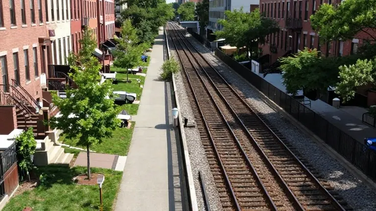
Jackson Wandres, a licensed urban architect and planner, recommends that the Metropolitan Transportation Authority expand the scope of its Interborough Express light rail project to include the construction of the Cross Brooklyn Greenway. The proposed light rail line is currently being designed to occupy the right-of-way of the former Bay Ridge Branch Railroad. Wandres argues that the two projects should be built together in the same corridor rather than separately.
The idea of a continuous trail in this specific right-of-way has a long history. Pedestrian and bicycle advocates first proposed the route thirty-five years ago. The concept appears in the 1993 New York City Department of Planning Report and reemerged in the August 2025 Greater Greenways plan. That recent plan was developed collaboratively by the Departments of Transportation, Parks and Recreation, and the New York City Economic Development Corporation.
Wandres states that the existing right-of-way is wide enough to accommodate both the light rail tracks and a greenway trail. He notes that adding the greenway to the current project would increase costs, but he believes the expense would be much lower than building the trail as a separate, later addition. The terrain presents specific engineering challenges because the former railroad line is not flat. South and west of 14th Avenue, the tracks sit in a deep cut below grade, while north and east of 14th Avenue, they are elevated on an embankment. Constructing the greenway will likely require retaining walls to convert sloped embankments into level surfaces for pedestrians and cyclists.
The design strategy involves separating the two facilities vertically to manage noise and access. The light rail would be placed in the middle of the right-of-way, either at the bottom of the cut or on top of the embankment, to keep it grade separated from adjacent streets. The greenway trail would ideally be built at the same elevation as the adjacent streets. This placement would ensure the trail is directly physically and visually accessible to residents and businesses along the route.
The route traverses multiple street grids in Brooklyn, connecting residential areas to Downtown Brooklyn and various arterial travel routes. Wandres describes this as a rare transportation corridor that links numerous trip generators, including shopping areas, jobs, educational facilities, and major parks. He compares its connectivity only to Kings Highway. The path would pass through neighborhoods such as Brownsville and East New York, which have some of the highest rates of chronic disease in the city and are among the least green areas in the borough.
Wandres, who has worked in city planning and design for over 35 years, views the project as an environmental justice and health equity initiative. The greenway would provide a car-free path to the Brooklyn waterfront for landlocked interior neighborhoods. The design includes trees, plantings, benches, drinking fountains, public toilets, exercise stations, and food vending kiosks. It would also feature green infrastructure for sustainable stormwater management.
The project aims to create a linear park that facilitates multi-modal travel by linking neighborhoods to each other and to the new light rail. Wandres expects that a properly funded facility would improve air quality, lower ambient temperatures, and reduce flooding in the surrounding areas. The plan is currently part of the public debate surrounding the Interborough Express feasibility and design process.
Source: BK Reader